SCROLLDOWN

SINCE 1999
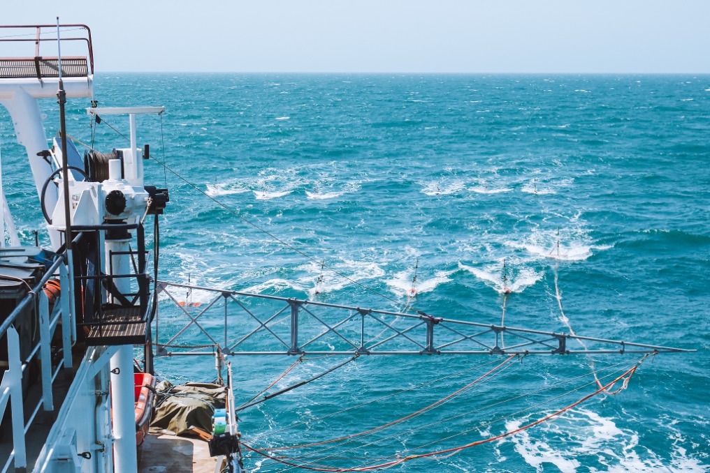
GeoSurveys has provided services in onshore and offshore geophysical surveying since 1999.
Our highly experienced team provide unique solutions for 2D & 3D marine Ultra-High Resolution Seismic in the survey design and planning, systems operations, data quality control, data processing and interpretation. R&D departments develop, trial and test new solutions to improve seismic systems and combined processing and interpretation solutions.
We have operated and successfully carried out projects all over the globe with many satisfied clients.
know moreGEOSURVEYS IN NUMBERS
GEOSURVEYS
CLIENTS AND PARTNERS


EVENTS


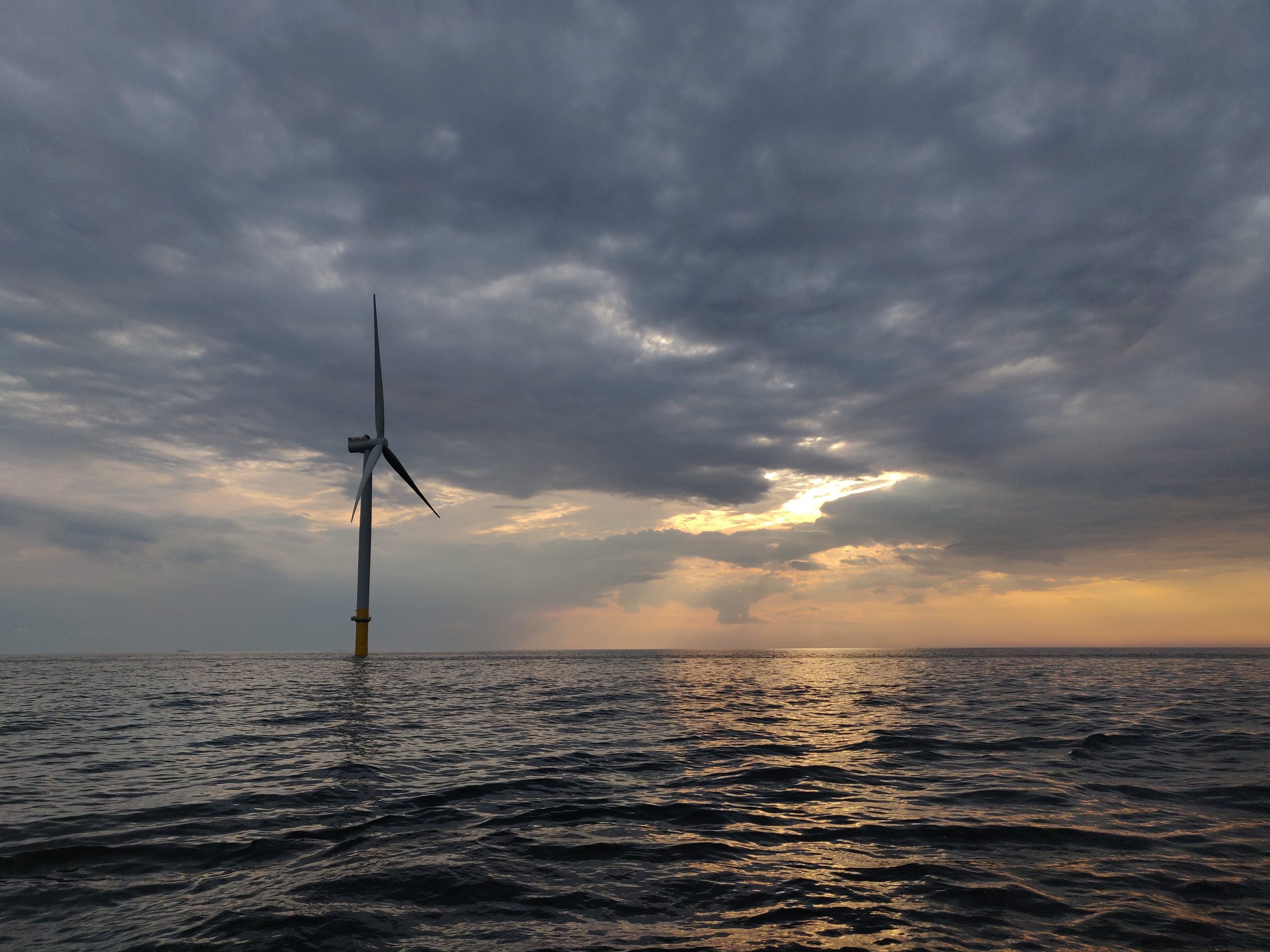
Authors: K.H. Karkov, E. Dalgaard, A.T. Diaz, H. Duarte, H.J. Hansen, S. Hviid, N.C. Høegh van Gilse, L. Krogh, S. Kuppens, G. Salaün and F. Correia Summary The development of offshore windfarms has increased worldwide. A thorough understanding of the subsurface geotechnical conditions for foundation design and installation is still more important as turbines are […]
Authors: H. Al-Khatib, G. Antonelli, A. Caffaz, A. Caiti, G. Casalino, I.de Jong, H. Duarte, G. Indiveri, S. Jesus, K. Kebkal, A. Pascoal and D. Polani, Abstract The WiMUST (Widely scalable Mobile Underwater Sonar Technology) project aims at expanding and improving the functionalities of current cooperative marine robotic systems, effectively enabling distributed acoustic array technologies […]
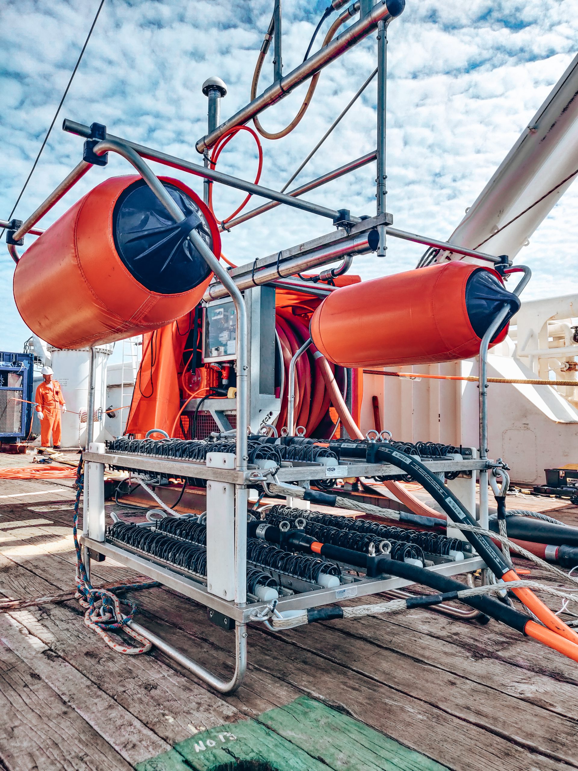
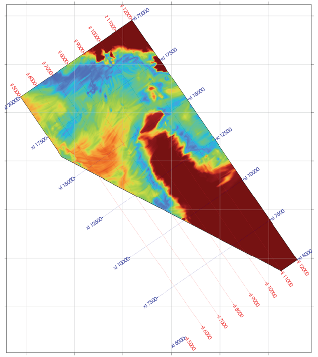
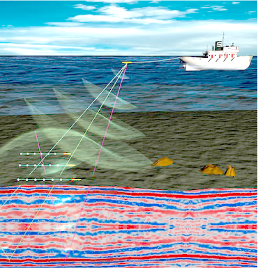
Authors: O. Monrigal, I. de Jong and H. Duarte ABSTRACT Currently, marine ultra-high-resolution 3D surveys tend to be characterized by signal frequency ranges of 0–600 Hz and bin sizes of the order of 3 to 6 metres. This may be acceptable in industry geohazard studies for top-hole well drilling, but it does not have sufficient […]
Read More from An ultra-high-resolution 3D marine seismic system for detailed site investigation
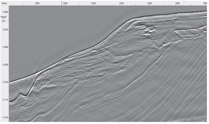
Authors: H. Duarte, N. Wardell and O. Monrigal ABSTRACT Traditionally, commercial ultra-high-resolution 3D multichannel seismic surveys have used sources with relatively low-frequency content (up to 600 Hz) with corresponding relatively low resolution. The new generation of multi-tip sparkers, however, utilising negative discharge technology, is able to produce repeatable high-frequency signals (above 2.5 kHz) with the […]
Read More from Advanced processing for UHR3D shallow marine seismic surveys