Authors: H. Duarte, N. Wardell and O. Monrigal
ABSTRACT
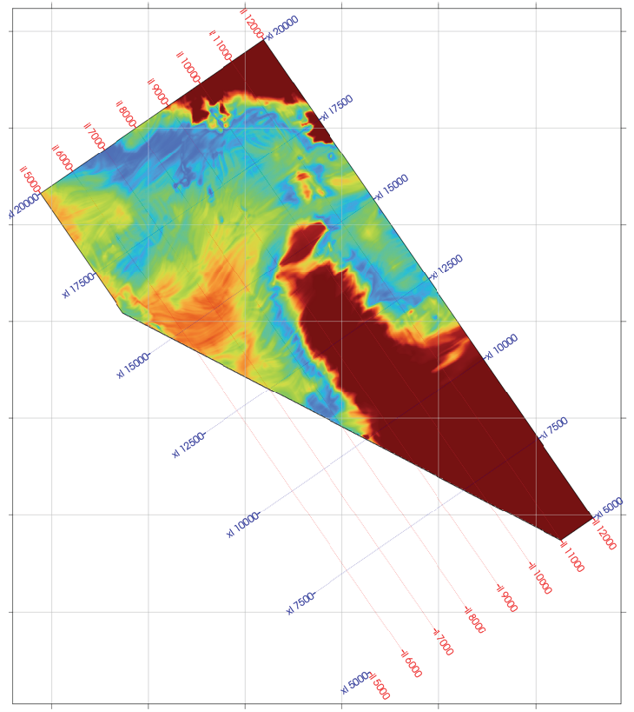
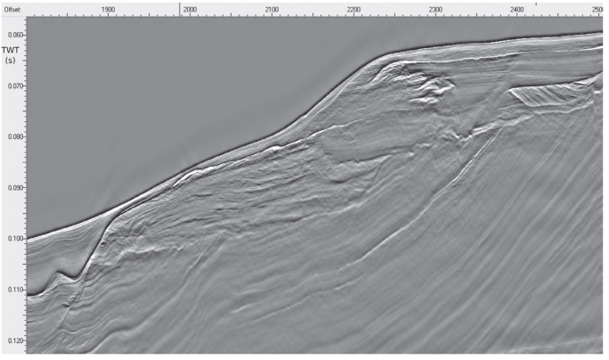
Traditionally, commercial ultra-high-resolution 3D multichannel seismic surveys have used sources with relatively low-frequency content (up to 600 Hz) with corresponding relatively low resolution. The new generation of multi-tip sparkers, however, utilising negative discharge technology, is able to produce repeatable high-frequency signals (above 2.5 kHz) with the potential to image hundreds of metres of the shallow stratigraphy at < 50 cm vertical resolution. These sources would be especially suited to ultra-high-resolution 3D studies such as the foundations of wind turbines installations for offshore wind farms.
However, simple downsizing of conventional processing sequences, designed for sources of significantly lower frequency content, is not enough. To preserve the signal properties of the sparker source and produce accurately positioned seismic images, new strategies are needed. The implementation of processing solutions that accurately determine source and receiver depths for all shots is also paramount to correctly reduce the data to the desired vertical datum.
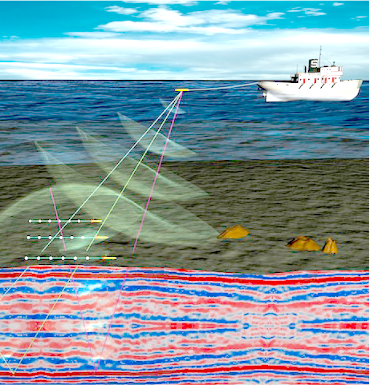
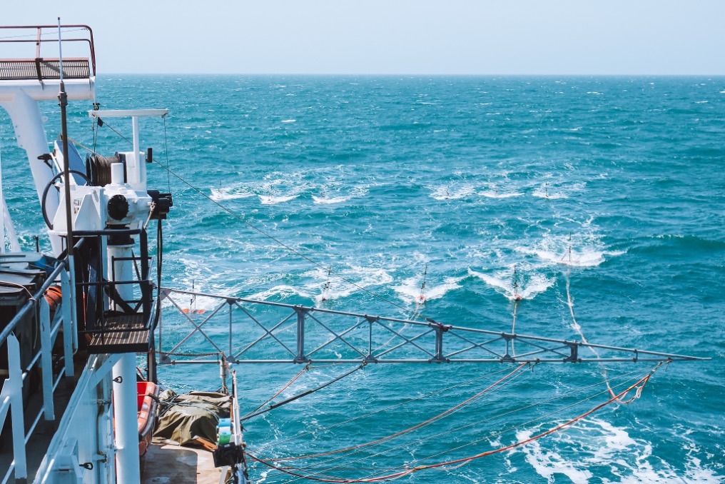
A basic methodology for deriving geometry and shot corrections for wave motion and tides from the 3D data themselves has already been demonstrated. With Differential Global Positioning System (DGPS) navigation available on both source and streamers and the correct integration of the seismic recording and positioning systems, this concept has been further developed and refined to be more precise. Being able to derive components of the streamer position and depth is of great importance for effective broadband processing from the slanting streamers that are deployed in acquisition. New procedures and processing techniques have been developed, and their efficacy is demonstrated on case studies of recently acquired 2D and 3D multichannel data.
Link: