UHRS Turnkey Services
For the past 14 Years GeoSurveys and Geo Marine Surveys Systems (GMSS) have been combining synergies to develop new 2D and 3D UHRS systems and to provide turnkey solutions to clients.
Our joint R&D departments develop, trial and test new solutions and approaches to improve the systems as well the processing solutions.
Supporting our clients from the tender phase to the final processed and interpreted product. A unique perspective from selecting the correct tools and all commercial aspects, understanding the schedule as well as the quality required to achieve the client goals

UHRS Consultancy
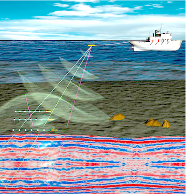
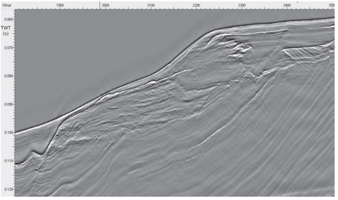
GeoSurveys, in partnership with Geo Marine Survey Systems, deploys a complete suite of technologies aiming at the enhancement of seismic data imaging. We provide solutions for high-resolution single and multichannel seismic 2D/3D acquisition in marine and fresh water environments.
Our team has vast experience in the design, planning, operation of systems, quality control of data, data processing and interpretation of 2D /3D UHRS surveys. Our solutions have been successfully implemented in a large variety of complex and challenging scenarios, from very shallow waters (2 to 6 meters water depth) to deep water (up to 3000 meters abyssal depths), very steep slopes of canyon margins and headwalls, delta fronts, reefs, etc., as well as the ever-challenging glacial deposits worldwide.

Survey Design and Planning
GeoSurveys will be actively involved since early stages of the project to support our clients. Our team makes use of their vast experience to effectively design, plan and execute even the most complex geophysical surveys and provide our clients with the best data for their value.
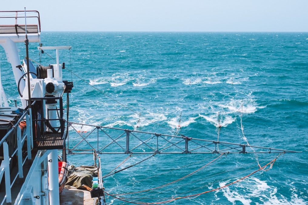
We select the systems according to the project specifications and local conditions; we design the most suitable line plan that meets the client’s demands and establish acquisition settings. Setup geometry to best fit the needs for the project and yield the best data for each specific setting and environment.
We offer to our clients the best solutions with proven results:
- Single and multiple source operations;
- Stacked sources and flip-flop triggering;
- Broad spectrum slanted streamer deployment;
- 3D surveying.

UHRS Data Processing
GeoSurveys develops and applies state of the art ‘high end’ processing solutions to 2D & 3D marine Ultra-High Resolution seismic data (UHRS). Specialized in broad band processing of UHRS, aimed at recovering the full frequency content of signal acquired in all sea states. To that end, GeoSurveys has in house developed advanced procedures for sparker source signature modeling, source and receiver deghosting and full seismic datum related static corrections that allow for the coherent stack of UHRS data acquired with source and receiver heave motion in excess of 3 m (seas of 2 m Hs).
By having control on the survey design and data quality we guarantee that the acquired 2D / 3D data is fit for the purpose of advanced processing flows that include key procedures such as trace by trace static corrections of source and receiver vertical motion, advanced pre-stack de ghosting, pre-stack and post-stack multiple attenuation techniques as also as pre-stack and post-stack migration.

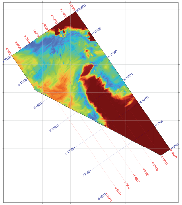
UHRS Data Interpretation
Our approach to 2D/3D UHRS is not limited to operations and data processing, which deliver unprecedented resolution and penetration. We also assess the UHRS data provide reliable and meaningful seismic interpretation results. Our geologists are expert in geological and structural interpretation, and skillful in subsurface features and geo-hazards mapping.

Onshore and Nearshore
UNDER CONSTRUCTION / SOON AVAILABLE